


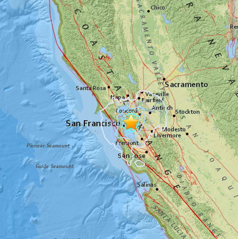
PIEDMONT—At 6:49 a.m. on Monday, August 17, a 4.0 magnitude earthquake shook the Bay area, according to the United States Geological Survey (USGS).
The earthquake occurred approximately 1 mile north of Piedmont, 2 miles northeast of Emeryville, 3 miles northeast of Oakland, 3 miles southeast of Berkeley and 65 miles southwest of Sacramento.
The specific source coordinates of the quake were 37.840°N and 122.231°W, with a depth of approximately 3.3 miles.
The quake occurred along the Hayward Fault, which runs through north San Pablo Bay to south Fremont, and passes through the cities of Berkeley, Oakland, Hayward and Fremont.
In 1868, the 12th most lethal earthquake in U.S. history occurred along the same fault. The earthquake took place at 7:53 a.m. on October 21, and had a magnitude that was estimated between 6.8 and 7.0 on the richter scale. This natural disaster resulted in 30 deaths and hundreds of thousands of dollars in property damage.
The Alameda County Courthouse in the City of San Leandro was decimated, as was the adobe chapel of Mission San José in Fremont. Multiple buildings in San Jose, San Francisco and Alameda County were destroyed. The city of Hayward saw the largest amount of devastation with nearly every single building being destroyed or severely damaged.
There is currently a 27 percent probability that the Hayward-Rodgers Creek Fault system will produce a magnitude 6.7 or larger earthquake in the next 30 years, according to the 2003 Working Group for California Earthquake Probability.
Local San Francisco resident Ashley Guerin caught the earthquake, along with her two dogs’ reactions, on tape.


.)